파일:South American plates.png
K-위키

미리 보기 크기: 607 × 600 픽셀 다른 해상도: 2,288 × 2,261 픽셀
원본 파일 (2,288 × 2,261 픽셀, 파일 크기: 1,005 KB, MIME 종류: image/png)

파일 설명
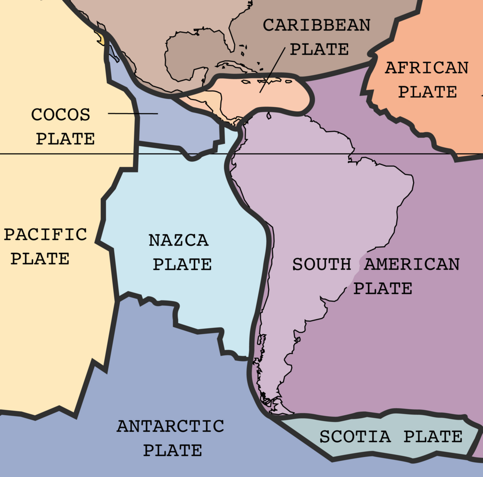
| 설명 | The key principle of plate tectonics is that the lithosphere exists as separate and distinct tectonic plates, which float on the fluid-like (visco-elastic solid) asthenosphere. The relative fluidity of the asthenosphere allows the tectonic plates to undergo motion in different directions. This map shows 15 of the largest plates. Note that the Indo-Australian Plate may be breaking apart into the Indian and Australian plates, which are shown separately on this map. |
| 날짜 | |
| 출처 | http://pubs.usgs.gov/publications/text/slabs.html |
| 저자 | USGS; cropped by Beyond My Ken (talk) 10:06, 27 February 2010 (UTC) |
| 다른 버전 |
|


|
|
 |
파일 역사
날짜/시간 링크를 클릭하면 해당 시간의 파일을 볼 수 있습니다.
| 날짜/시간 | 섬네일 | 크기 | 사용자 | 설명 | |
|---|---|---|---|---|---|
| 현재 | 2024년 9월 1일 (일) 09:19 | | 2,288 × 2,261 (1,005 KB) | commonswiki>RXFADEZ | restored Hispaniola to be a single island. Tried to preserve image format otherwise. Higher resolution |
이 파일을 사용하는 문서
다음 문서 1개가 이 파일을 사용하고 있습니다: